Lake Basin and The Sherwins - Mammoth Lakes, CA [EN/PT-BR]
[EN]
This post is a continuation of my last post, that can me seen here. As I explained in the last post, this was a long flight. I had so many pictures that I decided to split the post in 2, so it doesn't get too long.
I covered a very large area in one flight, even though I replaced batteries a few times, I'm counting as one flight since I had only one takeoff point. I flew in three different directions (north, south and west), and reached almost 1.8 Miles (3Km) each direction from my takeoff point. My takeoff point was 8000ft (2400m) above sea level, and I flew up to 1600ft (500m) above my takeoff.
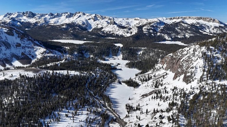
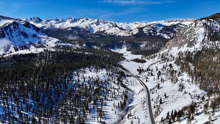
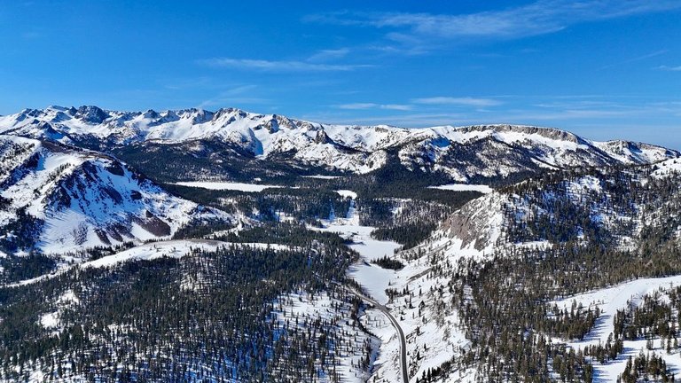
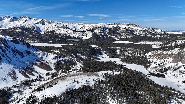
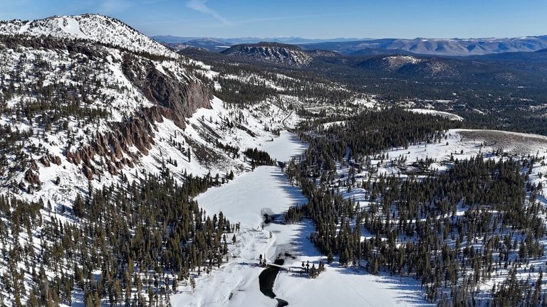
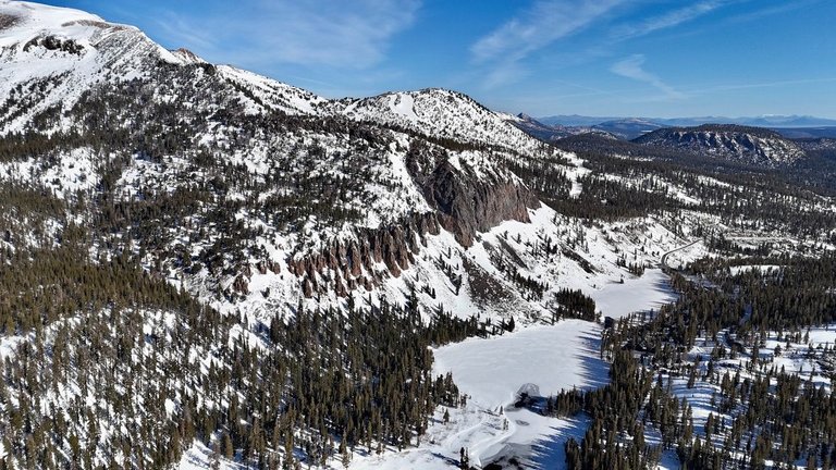
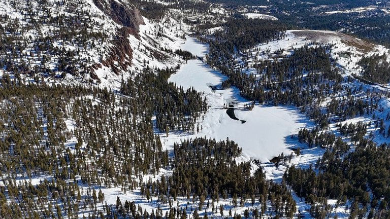
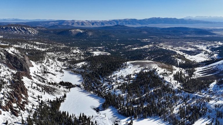
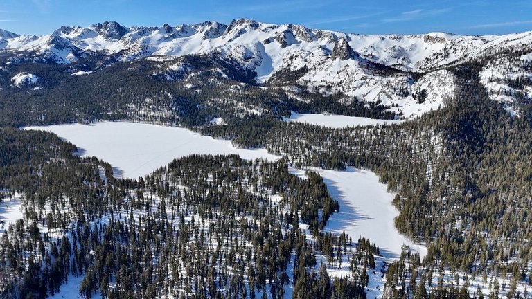
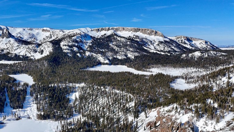
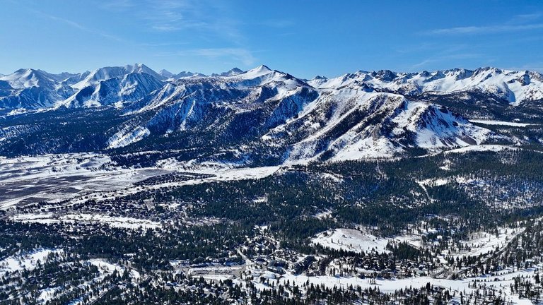
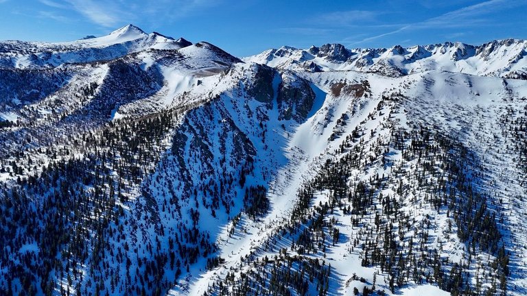
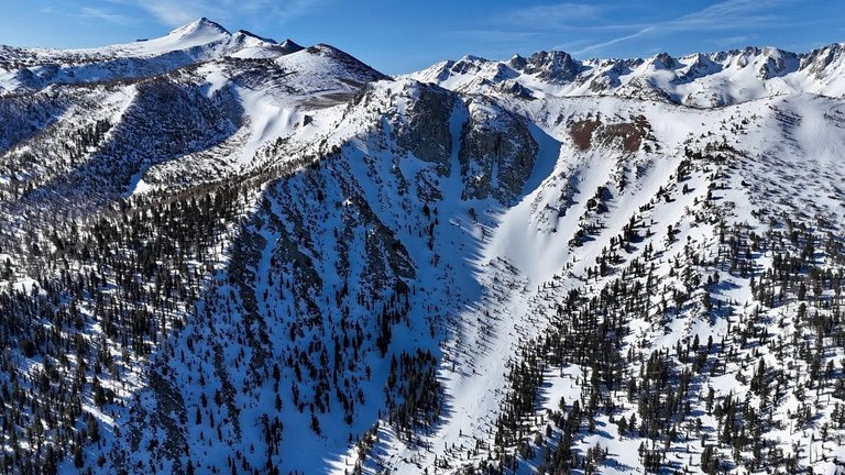
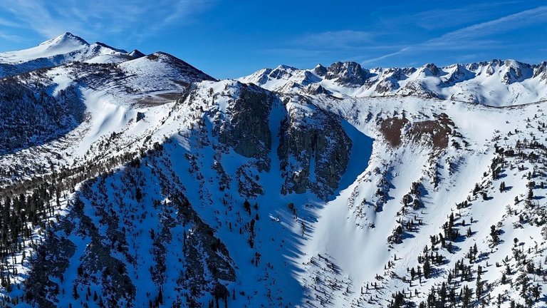
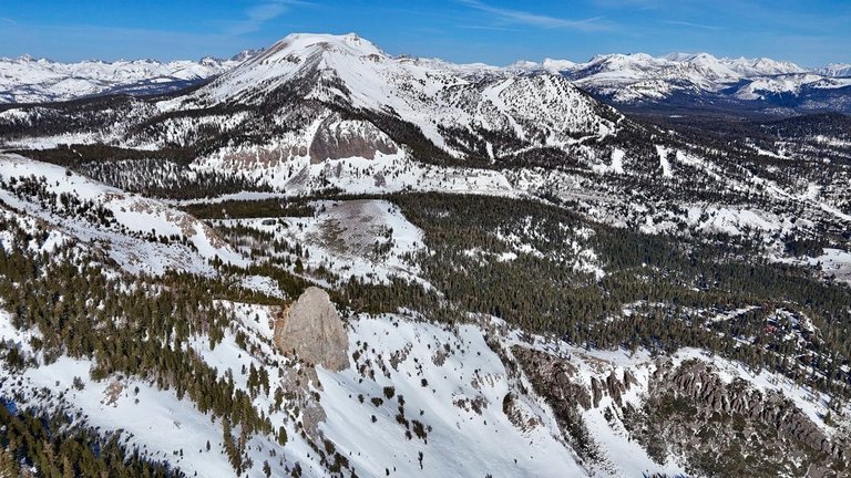
So today I will show the lakes and mountain ranges behind Mammoth Mountain (south). I think the first picture above is probably one my favorite pictures that I ever took with my drone, it includes many famous spots. You can see in the center Twin Lakes, the longer lake in the lower level. Twin Falls is at the end of Twin Lakes, a waterfall currently frozen. Above Twin Falls is Lake Mamie, then a little further is Lake George (you can see a little bit of it). To the right of Lake Mamie is Horseshoe Lake, and to the left is Lake Mary. Above Lake George you will see a big exposed rock called Crystal Crag, this is a very famous spot for photographers and climbers. The mountain range to the left of Crystal Crag is the Mammoth Crest. The picture was taken right above my takeoff point and you can see Mammoth Mountain (shown in my last post) to the right. In the next pictures you will see some different angles covering about the same as the first picture.
[PT-BR]
Este post é uma continuação do meu último post, que pode ser visto aqui. Como expliquei no meu último post, esse foi um voo longo. Eu tinha tantas fotos que decidi dividir o post em dois, para que não ficasse muito longo.
Cobri uma área muito grande em um único voo, apesar de ter trocado as baterias algumas vezes, estou contando como um só voo, já que tinha apenas um ponto de decolagem. Voei em três direções diferentes (norte, sul e oeste) e alcancei quase 3 km em cada direção a partir do meu ponto de decolagem. Meu ponto de decolagem estava a 8.000 pés (2.400 m) acima do nível do mar, e voei até 1.600 pés (500 m) acima da minha decolagem.
Portanto, hoje mostrarei os lagos e as cadeias de montanhas atrás da Mammoth Mountain (ao sul). Acho que a primeira foto acima é provavelmente uma das minhas fotos favoritas que já tirei com meu drone, pois inclui muitos pontos famosos. Você pode ver no centro Twin Lakes, o lago mais longo no nível inferior. Twin Falls fica no final de Twin Lakes, uma cachoeira atualmente congelada. Acima de Twin Falls está o Lake Mamie e, um pouco mais adiante, o Lake George (você pode ver um pouco dele). À direita do Lake Mamie está o Horseshoe Lake, e à esquerda está o Lake Mary. Acima do Lake George, você verá uma grande rocha exposta chamada Crystal Crag, um local muito famoso para fotógrafos e alpinistas. A cadeia de montanhas à esquerda do Crystal Crag é a Mammoth Crest. A foto foi tirada logo acima do meu ponto de decolagem e é possível ver Mammoth Mountain (do meu último post) à direita. Nas próximas fotos, você verá alguns ângulos diferentes que cobrem aproximadamente a mesma área da primeira foto.
[EN]
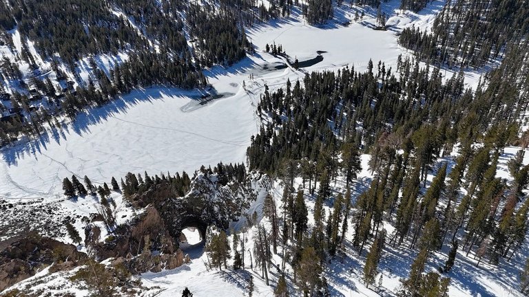
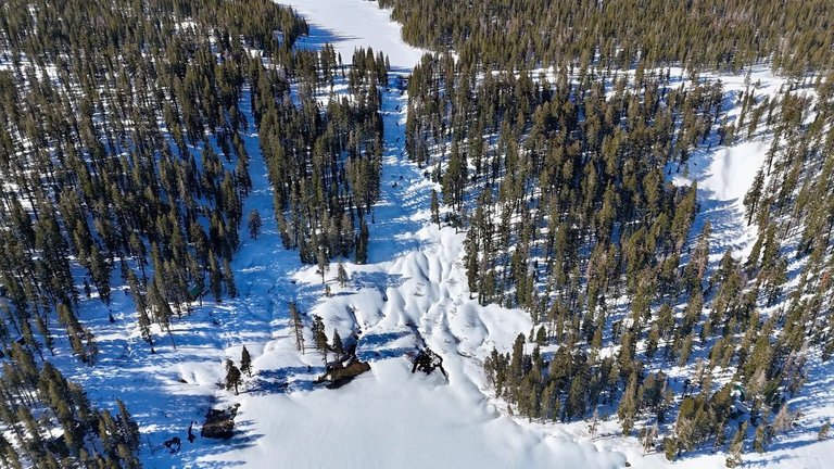
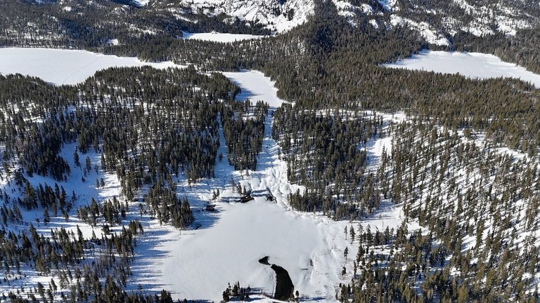
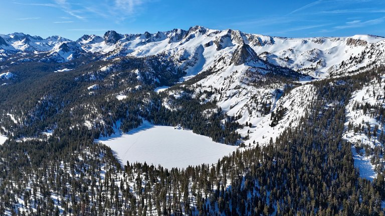
Let's see some pictures of Twin Lakes from different angles. The first one might be repeated from the first post, but I just wanted to show Hole In The Wall together with Twin Lakes.
[PT-BR]
Vamos ver algumas fotos de Twin Lakes de diferentes ângulos. A primeira pode ser repetida do último post, mas eu só queria mostrar Hole In The Wall junto com Twin Lakes.
[EN]
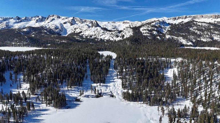
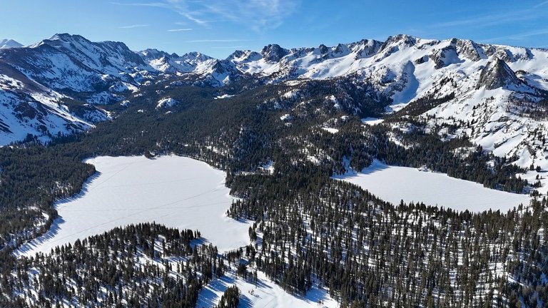
You can see the entire town of Mammoth Lakes in the center of the last picture. Now let's check out some pictures of Twin Falls.
[PT-BR]
Você pode ver a cidade inteira de Mammoth Lakes no centro da última foto. Agora vamos dar uma olhada em algumas fotos de Twin Falls.
[EN]
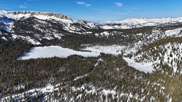
Next is Lake Mamie, Lake George and Lake Mary.
[PT-BR]
Agora Lake Mamie, Lake George e Lake Mary

[EN]
Now I got only a very few pictures including only Horseshoe Lake, here it is. But if you look close in these next pictures, you can see another lake a little further, close to the mountains, that's McLeod Lake. I couldn't get any closer or get more pictures of that lake as my drone signal wouldn't reach.
[PT-BR]
Tenho poucas fotos, incluindo apenas o Horseshoe Lake, são essas duas. Mas se você olhar com atenção nas próximas fotos, poderá ver outro lago um pouco mais longe, perto das montanhas, que é o McLeod Lake. Não consegui chegar mais perto nem tirar mais fotos desse lago, pois o sinal do meu drone não chegava.
[EN]
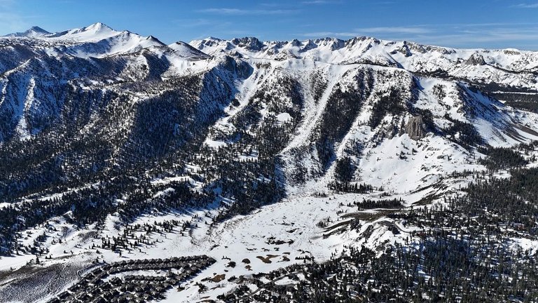
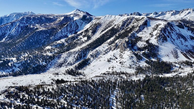
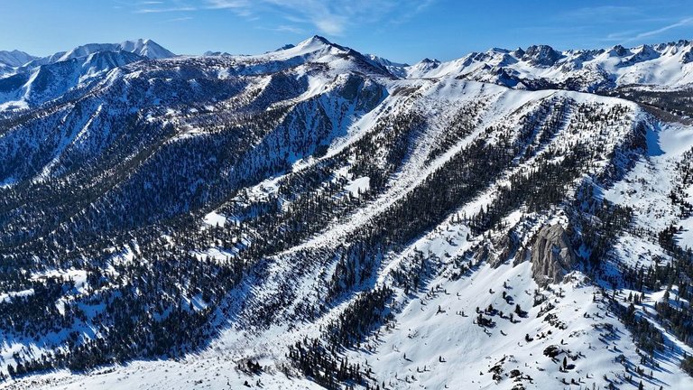
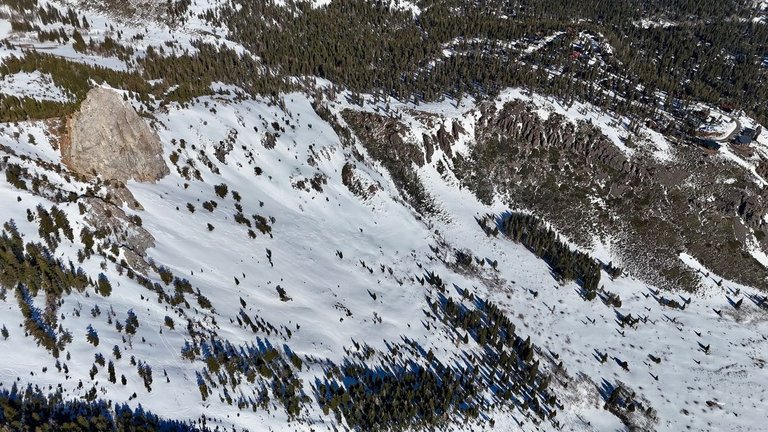
Now I'm moving on to The Sherwins, and I have so many memories from that place! I use to hike that mountain almost every weekend in the spring back in the late 90's. I snowboarded down almost every possible line in that face all the way up to Rock Chute (a huge couloir).
A perfect day would start going to Main Lodge at the resort, taking the gondola all the way to the top, snowboarding down the backside of Mammoth, going thru Hole In The Wall, then walk across Lake Mary, and start hiking up the ridge of The Sherwins to grab some fresh snow. The hike would usually take 2-3 hours depending on how far was the spot we wanted to hit.
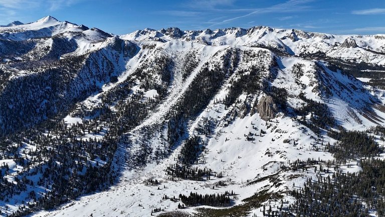
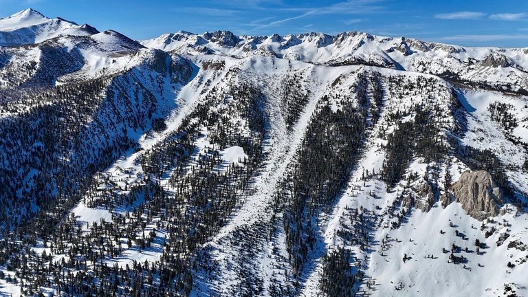
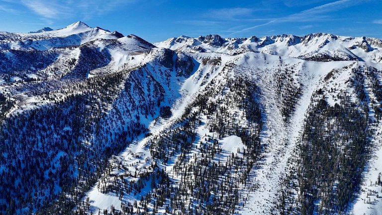
The first picture below shows all The Sherwins, the hike mentioned above starts at the right edge of this picture, and in the center right you can see Mammoth Rock, another famous spot. All the way in the back, top right, you can see Crystal Crag, and Mammoth Crest is behind The Sherwins. Rock Chute is around the center of the picture, a little to the left, just follow the ridge line until you see a big couloir, and I never hiked any further from that. Rock Chute is a very famous spot too for skiers and snowboarders, that drop can take your breath away. Then check out the entire sequence of photos all the way to Rock Chute.
[PT-BR]
Agora estou indo para The Sherwins, e tenho muitas lembranças desse lugar! Eu costumava escalar essa montanha quase todo fim de semana na primavera, no final dos anos 90. Eu descia de snowboard por quase todas as linhas possíveis naquela face até Rock Chute (um couloir enorme).
Um dia perfeito começava indo ao Main Lodge (no resort), pegando a gôndola até o topo, praticando snowboard na parte de trás de Mammoth, passando pelo Hole In The Wall, depois atravessava o Lake Mary e começava a subir o cume do The Sherwins para pegar neve fresca. Em geral, a caminhada levava de duas a três horas, dependendo da distância do local que queríamos descer.
A primeira foto abaixo mostra todos o Sherwins, a caminhada mencionada acima começa na borda direita da foto e, no centro à direita, você pode ver a Mammoth Rock, outro ponto famoso. Ao fundo, no canto superior direito, você pode ver Crystal Crag, e Mammoth Crest está atrás dos Sherwins. Rock Chute fica no centro da imagem, um pouco à esquerda, basta seguir a linha do cume até ver um grande declive, e nunca mais caminhei além disso. Rock Chute também é um local muito famoso para esquiadores e praticantes de snowboard, essa queda é de tirar o fôlego. Depois veja a sequencia de fotos até Rock Chute.
[EN]
Hope you enjoyed it. See you next time!
[PT-BR]
Espero que tenham gostado. Até a próxima!
You can check out this post and your own profile on the map. Be part of the Worldmappin Community and join our Discord Channel to get in touch with other travelers, ask questions or just be updated on our latest features.
Obrigado por promover a comunidade Hive-BR em suas postagens.
Vamos seguir fortalecendo a Hive
Bzzt! Que lugar incrível, mais uma vez Mengao me surpreende com suas fotos épicas! A vista do lago e do Monte Mammoth é simplesmente linda. Meu favorito é o primeiro, com todos os lagos e montanhas em um único frame, é um trabalho de arte!
#hivebr
AI generated content
Commands: !pixbee stop | !pixbee start | !pixbee price
Your post was manually curated by @crazyphantombr.
Delegate your HP to the hive-br.voter account and earn Hive daily!
🔹 Follow our Curation Trail and don't miss voting! 🔹
Congratulations @mengao! You have completed the following achievement on the Hive blockchain And have been rewarded with New badge(s)
Your next target is to reach 350 posts.
You can view your badges on your board and compare yourself to others in the Ranking
If you no longer want to receive notifications, reply to this comment with the word
STOPEssa é uma viagem que deve ser muito top de fazer. Muito doido ter um buraco na montanha o "Hole In The Wall" e ainda mais fazer snowboard e passar por ele.
Deve ter sido erosão e talvez água de quando descongela passando ao longo dos anos né?
Provavelmente. Como diz o ditado, agua mole, pedra dura tanto bate até que fura.
Aquela região toda foi muito abençoada pela natureza. Tem muita coisa interessante.
Verdade o ditado nunca falha rs.
Hiya, @ybanezkim26 here, just swinging by to let you know that this post made it into our Top 3 in Travel Digest #2529.
Your post has been manually curated by the @worldmappin team. If you like what we're doing, please drop by to check out all the rest of today's great posts and consider supporting other authors like yourself and us so we can keep the project going!
Become part of our travel community:
These shots are epic! Well deserved to be at the top of today's Travel Digest!
Thank you 🙏
wow its just amazing how anyone with a drone can take spectacular photographs of the surface of planet earth... something you needed an airplane and high end camera gear to do five years ago...
I wish I had these drones 20 years ago, when I used to hike all those mountains. Imagine using the drone to take pictures of us there, then following me riding down making a video. Crazy technology nowadays.
https://www.reddit.com/r/mountains/comments/1opwi9v/the_sherwins_where_mountains_touch_californias_sky/
This post has been shared on Reddit by @arqyanedesings through the HivePosh initiative.