Vuelo de Dron limitado, pero realizado. || Limited drone flight, but accomplished.
Hoy ha sido un día de mucho trabajo de campo, es decir: tuvimos con mi esposa trabajando fuera de la oficina realizando tomas aéreas, fotografías terrestre, colocando carteles y mucho más.
Today has been a day of hard fieldwork. That is to say, my wife and I were working outside the office, taking aerial shots, ground photography, posting signs, and much more.
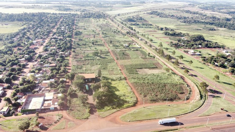
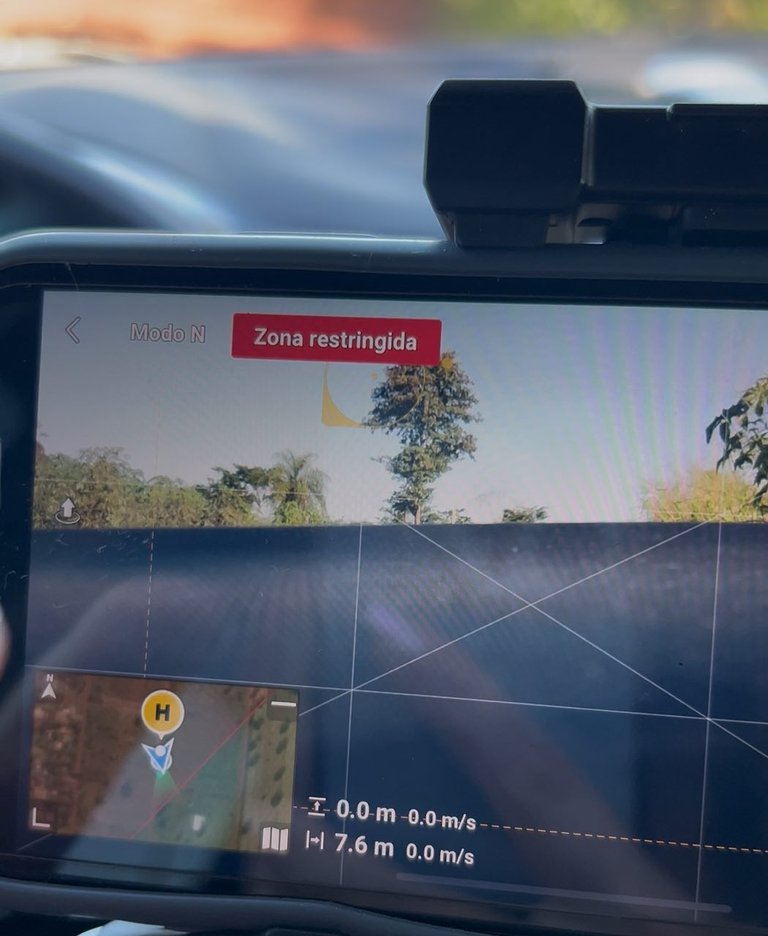
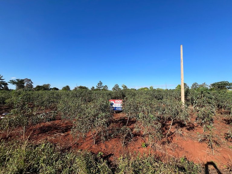
Hoy, después de mucho tiempo me encontré con un impedimento de volar, es decir: cuando intento despegar con el Drawn, resulta que estaba a unos metros dentro de la zona restringida de vuelo, esto surge porque la aplicación restringe el vuelo en zona de aeropuerto ya que representa un peligro a las aeronaves, aunque este aeropuerto en particular tiene muy poca frecuencia de vuelos Y los pocos aviones que despegan de ahí son pequeños. Entonces para poder realizar una toma aérea del terreno, la propiedad que tenemos en venta solamente me alejé unos 50 m de la franja de zona restringida, realicé unas tomas aéreas desde otro ángulo, era necesario las fotos aéreas cheque la propiedad contaba con muchas plantaciones de mandioca y esto impedía en cierta manera que se pueda divisar muy bien el cartel que coloque.
Today, after a long time, I encountered a flight restriction. When I tried to take off with Drawn, it turned out I was a few meters inside the restricted flight zone. This is because the app restricts flying in the airport area because it poses a danger to aircraft. This particular airport has very low flight frequency, and the few planes that take off from there are small. So, in order to take an aerial shot of the land—the property we have for sale—I moved about 50 meters away from the restricted zone. I took some aerial shots from a different angle. The aerial photos were necessary. I checked the property had many cassava plantations, and this somewhat prevented me from clearly seeing the sign I placed.
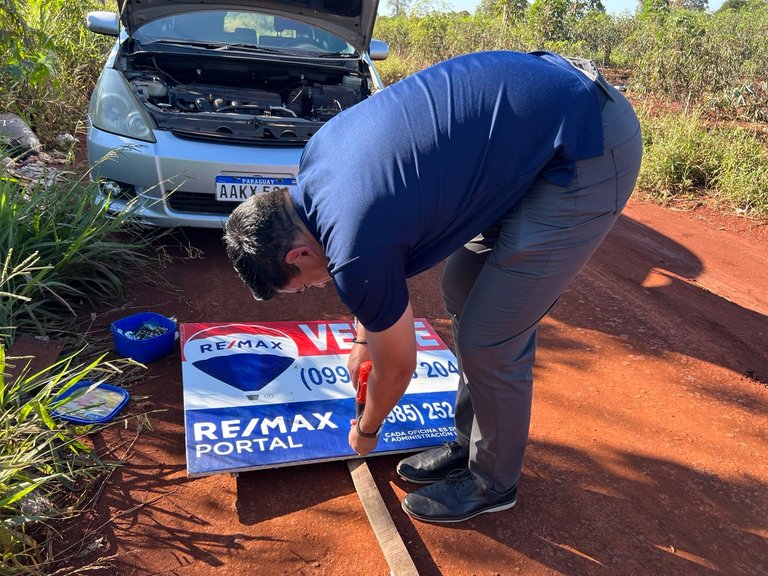
Luego el desafío fue como colocar el cartel, agarré unas maderas y con tornillos y el taladro eléctrico hice una especie de T para colocar el cartel, como mi taladro no tiene una batería porque ya es muy viejo lo conecté a la batería del vehículo y funcionó de maravillas. Arme el cartel y quedó impecable, después de ello la tarea que seguía era hacer un poso para introducir el poste. En este caso la tierra era muy blanda ya que era una zona de plantación de mandioca y la superficie era bastante arenosa, hice el pozo sin mayores inconvenientes e introdujo el poste, quedó Super rígido.
The next challenge was how to put up the sign. I grabbed some wood and, using screws and an electric drill, made a sort of T-shaped structure to hang the sign. Since my drill doesn't have a battery because it's very old, I connected it to the vehicle's battery, and it worked like a charm. I assembled the sign and it looked impeccable. After that, the next task was to dig a hole to insert the post. In this case, the soil was very soft since it was a cassava plantation area, and the surface was quite sandy. I dug the hole without any major problems and inserted the post; it was super rigid.
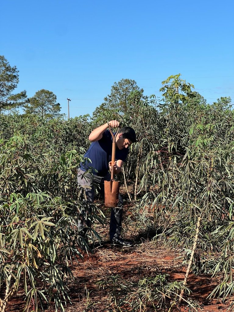
Todo esto y las imágenes registradas fueron solamente de una de las propiedades, más tarde fuimos a otra propiedad en la que tenía la vegetación a más de 1 m de altura y tuve que entrar para buscar las marcas que delimitaba en la propiedad, para mí fue muy divertido, fue un show, y el resultado fue que no encontré las marcas, pero me posiciones en donde creía que sería la Ubicación y realice las tomas aéreas con el Dron, ya en casa puedo procesar las imágenes insertarlas en un mapa y así poder obtener las coordenadas casi exactas que delimitan cada uno de los terrenos que tengo a la venta. De esta forma fue parte de la tarde de trabajo junto con @egonz.
All this and the images recorded were only from one of the properties, later we went to another property where the vegetation was more than 1 m high and I had to go in to look for the marks that delimited the property, for me it was very fun, it was a show, and the result was that I did not find the marks, but I positioned myself where I thought it would be the Location and took the aerial shots with the Drone, already at home I can process the images, insert them into a map and thus be able to obtain the almost exact coordinates that delimit each of the lands I have for sale. In this way it was part of the afternoon of work together with @egonz.


Lo relatado en esta publicación es 100% de mi autoría, ha salido de mi cerebro por mi experiencia, fracasos y estudio de distintas fuentes. Cualquiera que quiera tomar parte de este relato puede solicitar el permiso correspondiente para hacerlo.
Mis logros.


Diseño: Banner realizado por @egonz
0
0
0.000
🎉🎉🥳 Congratulations 🥳🎊🎊
Your post has just been curated and upvoted by Ecency
keep up the good work
Join us on the Ecency Discord