Mesopotamian Geography
After some more research was notable my previous post over archeology wasn't complete. (Link)
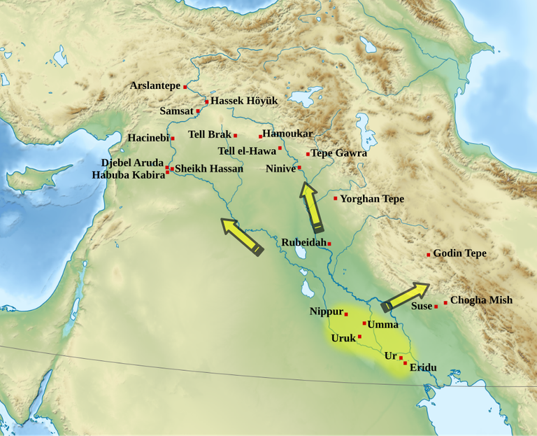
This map was a great help on how used to be Mesopotamia (Between Rivers, etymologically, and by that it's meant Tigris and Euphrates).
Basically yeah, Persia is so close that all the previous post ponderation makes a lot of sense. It just lacked more Info, Sites and History...
First I'll just drop some more amazing images over stuffs that were missing and that I found interesting, then we talk history.
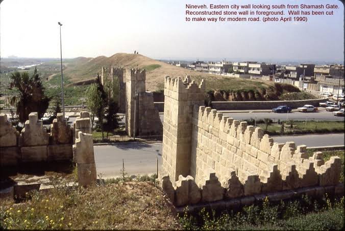
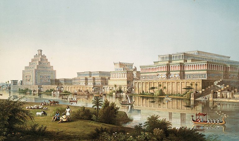
Still at Sumer we have one the most important historical cities, Nineveh, that I remember quoted in some readings. Deal is that ruins were a lot reconstructed and around urban area, anyway, no idea it used to be so nice with Tigres river passing through it. Also called an Assyrian city and on Upper Mesopotamia, Northern Iraq.
It's Hanging Gardens is mentioned by some historians as possibly 1 of the 7 Wonders of Ancient World, I tryied to search about and honestly dunno from where this talk surged, like wtf? It is or isn't? Lol, it's something quoted at books that they didn't know where was and probably suggested it was there. The only of the 7 wonders location that has not been definitively established. So there are 3 theories, or it was at Babylon or at Nineveh or it was simply mythical.

The shift from hunter-gathering to agricultural settlement, the first major revolution in human history, originated in the area between the Tigris and Euphrates River. Later, a second great revolution took place, the emergence of urban life, which developed into the economic and political organization of states.
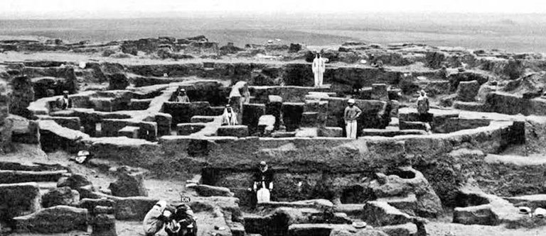
Close to Nineveh and near Tigris east side, it was a commercial and craft center, pioneers in metal and glass workings.
Well, but more interesting to me is how indeed Persian (Iranian) main sites are closer to main Sumerian cities than all others Iraqis sites themselves, which makes all the basis for the discussion... And by that I mean beyond Suse and the previously quoted sites, there is the Godin Tepe and Chogha Mish also displayed on map and that were skipped, but they were mainly settlement areas near Chogha Zanbil (that indeed has a ziggurat quoted in older post, and I honestly think more important infos were mentioned than containing in this map geography), it's kinda weird to search because you find mixed images from their sites due close proximation... And well, of course I don't have all that knowledge and am learning while writing, so way more lacking info will remain cause I'm not ignorant to tell wtf happened exactly lmao, throwing facts over uncertainty. What are archeologists/anthropologists doing if not trying to re-discover history?! So lets keep going...
Deal is that they were like stops on Great Khurasan Road (Trade/Silk Road) beginning and transitioning history from a mainly nomad culture, even refered as a Sumerian Trade Center. Both beer and wine were brewed at Godin Tepe, quoted as the largest settlement in the area, site was a lot destroyed by earthquakes, I couldn't find any good image. The interesting part is that these initial centers indeed linked Mesopotamia to Central Asia (China) and Indus Valley and indirectly linking it to Europe via Persian Royal Road, where Greek and Romans traders could have access. Sounds like there are more interesting topics to search now... What did you spot?
Congratulations @dstampede! You have completed the following achievement on the Hive blockchain And have been rewarded with New badge(s)
Your next target is to reach 3500 upvotes.
You can view your badges on your board and compare yourself to others in the Ranking
If you no longer want to receive notifications, reply to this comment with the word
STOP