Katovická Hora and its surroundings (for #WednesdayWalk)
(Google translate from Czech)
Neplánované akce asi bývají ty nejlepší. Občas se ale stane, že u sebe nemám takové vybavení, jaké by bylo potřebné. Asi si budu muset udělat do auta bednu se základním vybavením pro neplánované výlety :-).
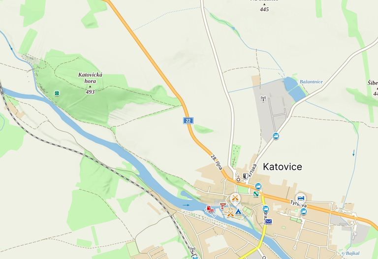
Sobotní ráno začalo budíkem v 05:00. Žena potřebovala odvézt do práce. Stalo se. Jenže pak jsem místo domů jel kousek za Strakonice do Katovic. Jezdím služebně často kolem místní Katovické Hory a chtěl jsem to tam trochu prozkoumat.
Sobotní ráno začalo budíkem v 05:00. Žena potřebovala odvézt do práce. Stalo se. Jenže pak jsem místo domů jel kousek za Strakonice do Katovic. Jezdím služebně často kolem místní Katovické Hory a chtěl jsem to tam trochu prozkoumat.
Unplanned events are probably the best. But sometimes it happens that I don't have the equipment I need. I'll probably have to pack a box of basic equipment for unplanned trips in my car :-).
Saturday morning started with an alarm at 05:00. My wife needed a ride to work. It happened. But then instead of going home, I drove a little beyond Strakonice to Katovická Hora. I often drive around the local Katovická Hora for business and I wanted to explore it a bit.
Saturday morning started with an alarm at 05:00. My wife needed a ride to work. It happened. But then instead of going home, I drove a little beyond Strakonice to Katovická Hora. I often drive around the local Katovická Hora for business and I wanted to explore it a bit.
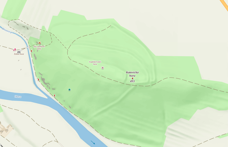
V dávné historii (asi 9 století) zde stálo hradiště(1), pod Horou je starý most(2) a ve dvacátých letech minulého století se tu těžil grafit(3).
To už stojí za trochu námahy a pár kroků navíc :-).
To už stojí za trochu námahy a pár kroků navíc :-).
In ancient history (about 9 centuries) there was a fort(1) here, there is an old bridge(2) below the Hora and in the 1920s graphite(3) was mined here.
That's worth a little effort and a few extra steps :-).
That's worth a little effort and a few extra steps :-).

Nejdříve se však podíváme na pár fotografií z Katovic.
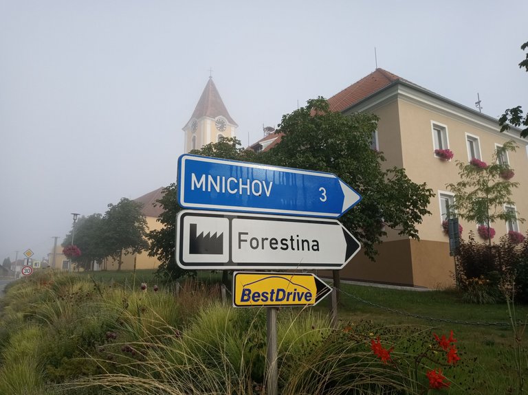
Opravdu nejsme v Polsku, ale v jižních Čechách. A už vůbec nejsme 3 km od bavorského Mnichova :-).
Opravdu nejsme v Polsku, ale v jižních Čechách. A už vůbec nejsme 3 km od bavorského Mnichova :-).
First, let's take a look at some photos from Katovice.
We are not really in Poland, but in southern Bohemia. And we are not even 3 km from Munich in Bavaria :-)
We are not really in Poland, but in southern Bohemia. And we are not even 3 km from Munich in Bavaria :-)
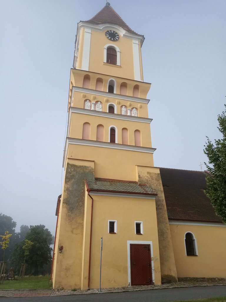
Na místní poměry netradiční stavba kostela s apoštoly ve výklencích věže.
A church with apostles in the niches of the tower, which is unusual for the local conditions.
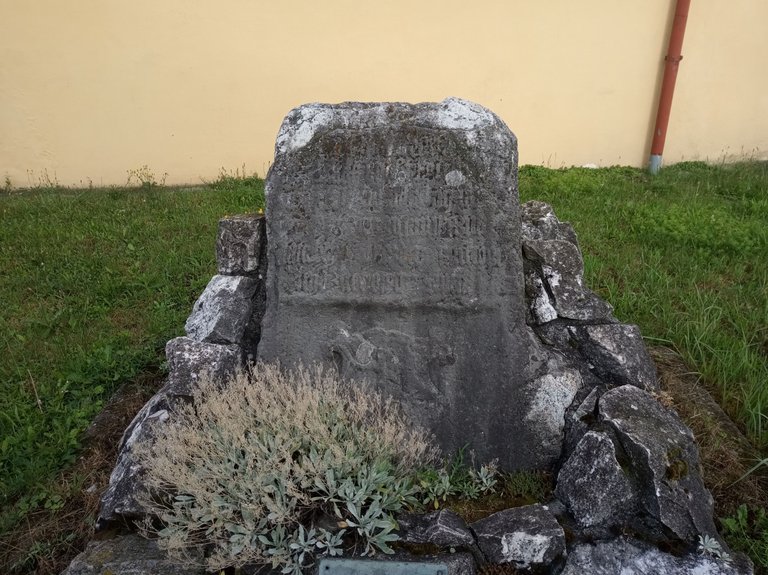
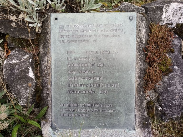
Za kostelem je instalovaná „Tajemná deska“ se skoro nečitelným nápisem. V minulosti několikrát změnila své stanoviště. Původně byla u kostela, pak pod Katovickou Horou a pak se zase vrátila ke kostelu. „Čiperný kámen“ :-)
Behind the church is a "Mysterious Board" with an almost illegible inscription. It has changed its location several times in the past. It was originally by the church, then under Katovická Hora, and then returned to the church. A „sharp stone" :-)
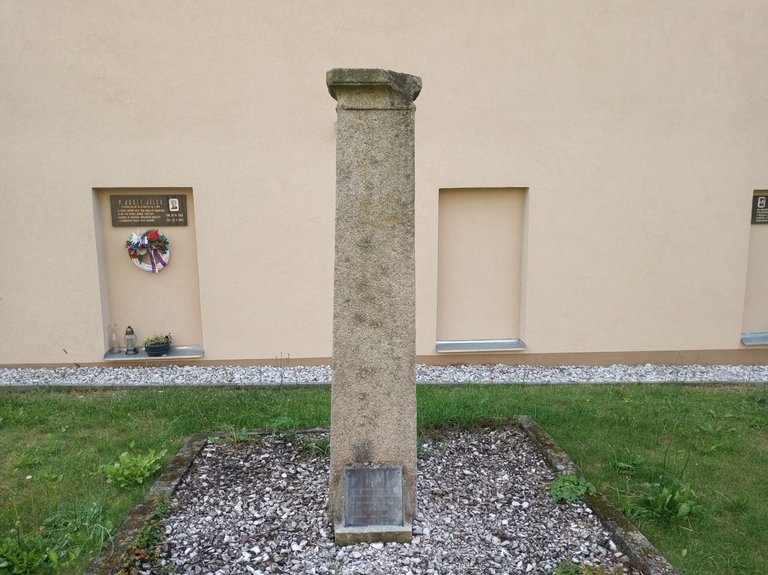
Naproti desce je sloup bývalého pranýře. Ten stával původně také jinde.
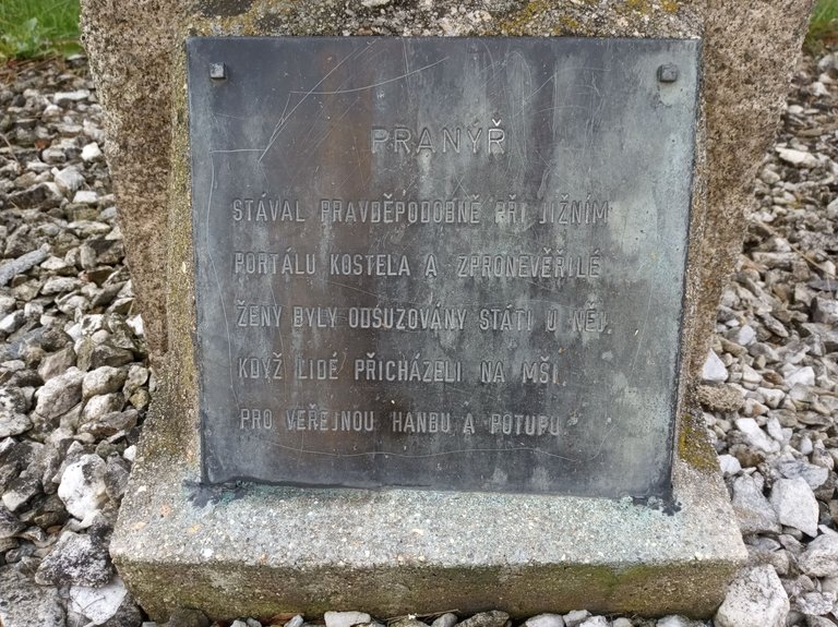
„Zpronevěřilé (nevěrné?) ženy byly odsuzovány státi u něj, když chodili lidé na mši, pro veřejnou hanbu a potupu“.
„Zpronevěřilé (nevěrné?) ženy byly odsuzovány státi u něj, když chodili lidé na mši, pro veřejnou hanbu a potupu“.
Opposite the plaque is the column of the former pillory. It originally stood elsewhere as well.
"Unfaithful" (unfaithful?) women were condemned to stand by it when people went to mass, for public shame and disgrace".
"Unfaithful" (unfaithful?) women were condemned to stand by it when people went to mass, for public shame and disgrace".
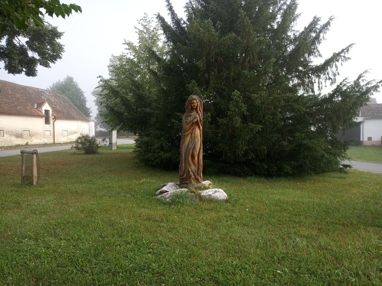
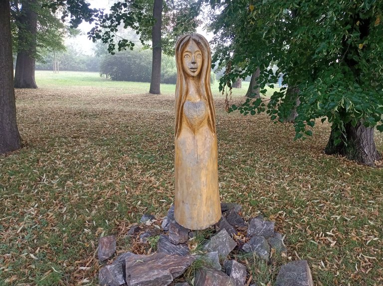
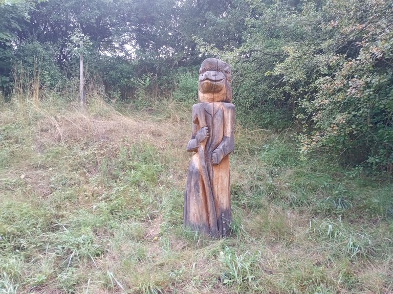
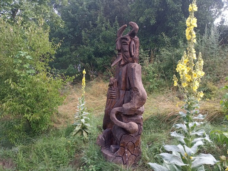
Za kostelem a v malém parku je několik dřevěných soch.
Behind the church and in a small park are several wooden statues.
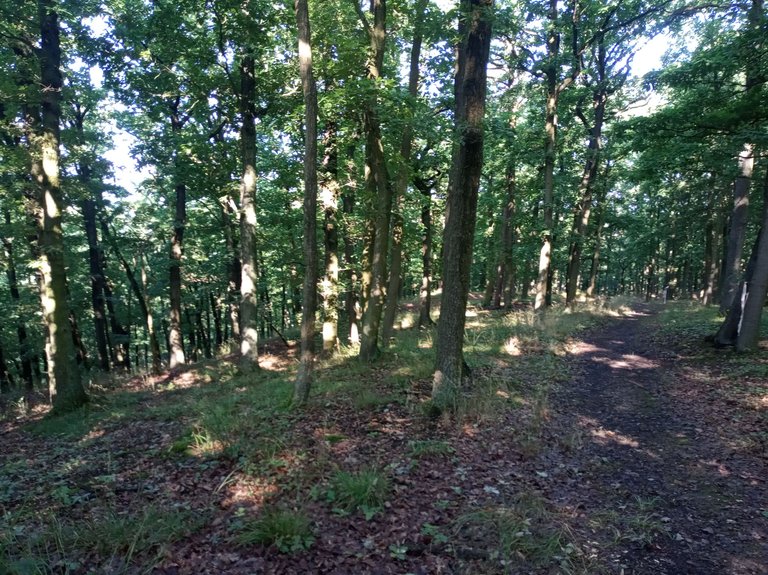
Opustíme městys. Čeká nás procházka ke Katovické Hoře.
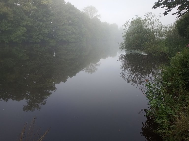
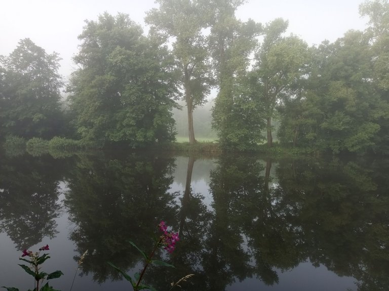
Dobře značená (červeně) turistická stezka slouží i jako cyklo - stezka mezi Strakonicemi a Horažďovicemi. Je z ní výhled na řeku Otavu,
Dobře značená (červeně) turistická stezka slouží i jako cyklo - stezka mezi Strakonicemi a Horažďovicemi. Je z ní výhled na řeku Otavu,
We leave the town. A walk to Katovická Hora awaits us.
A well-marked (red) hiking trail also serves as a cycling trail between Strakonice and Horažďovice. It offers a view of the Otava River,
A well-marked (red) hiking trail also serves as a cycling trail between Strakonice and Horažďovice. It offers a view of the Otava River,
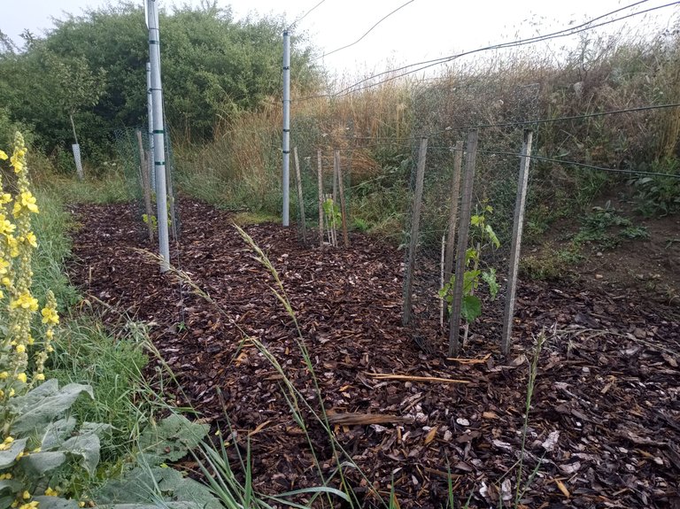
mineme Vinořad (jedna řada vinné révy),
we pass Vinerow (one row of vines),
několik dřevěných soch
several wooden statues
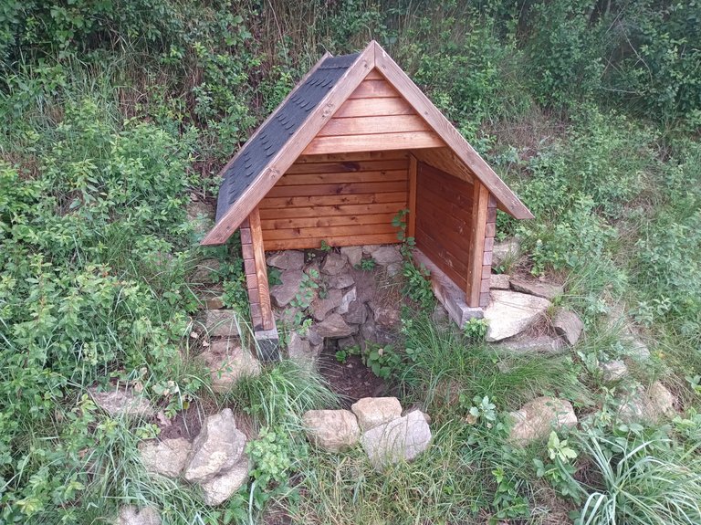
a také studánku, která je bohužel bez vody.
and also a spring, which unfortunately has no water.
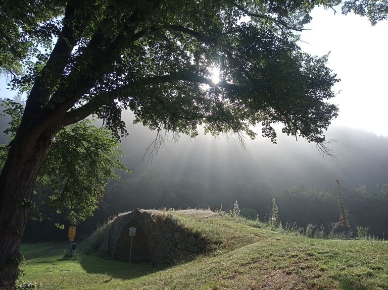
A jsme pod Horou.
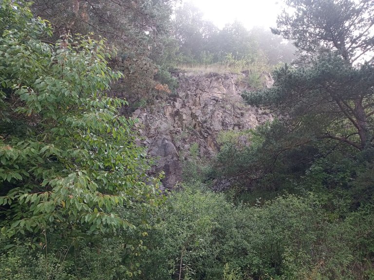
Na jižním úbočí vystupují nějaké skály
Na jižním úbočí vystupují nějaké skály
And we are below Mountain.
Some rocks stand out on the southern slope
Some rocks stand out on the southern slope
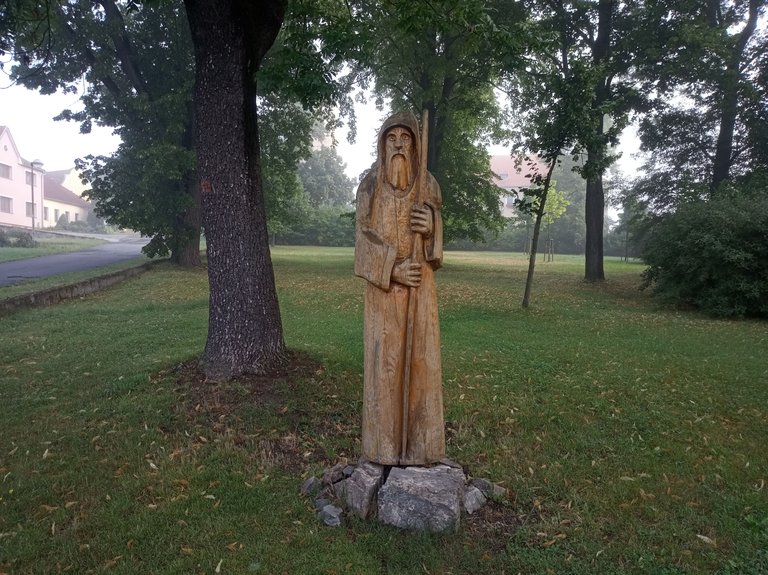
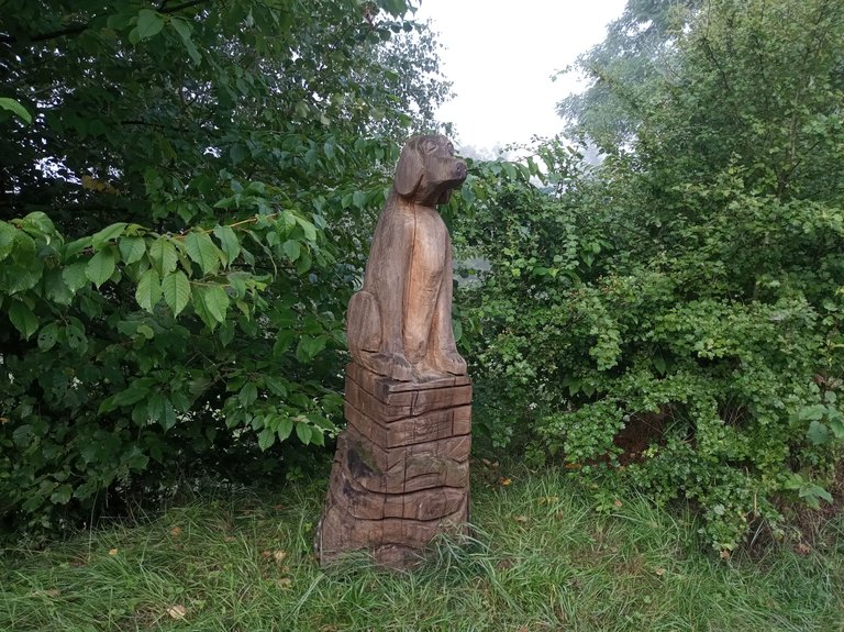
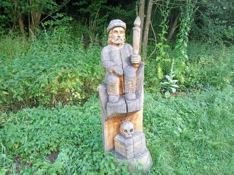
a klid Hory hlídá Strážce pokladů.
and the peace of the mountain is guarded Treasure Keeper.
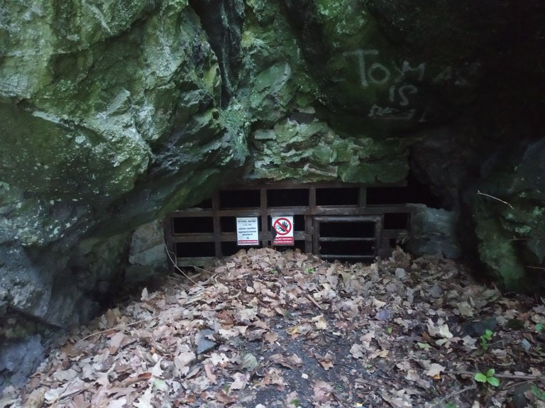
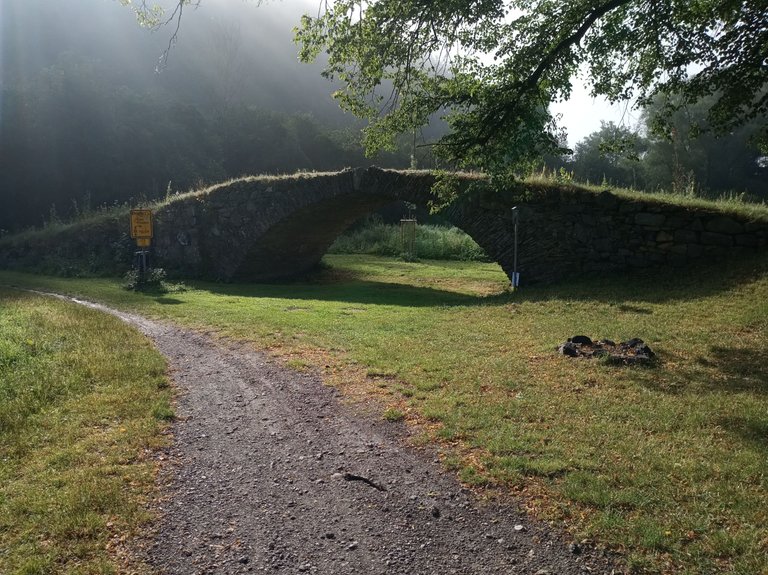
U malého můstku zabočíme doprava. Čeká nás dost příkré stoupání na vrchol Hory.
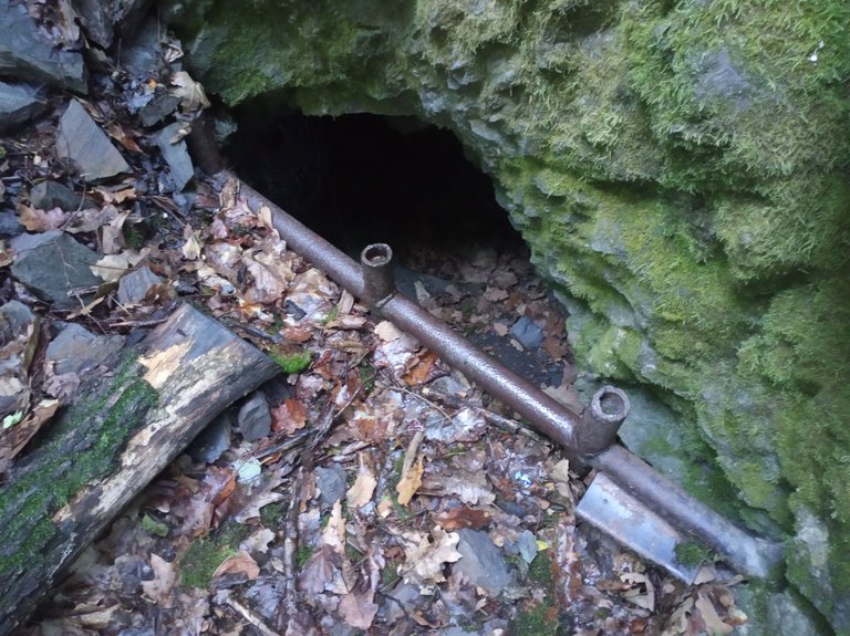
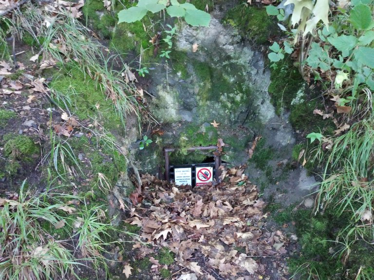
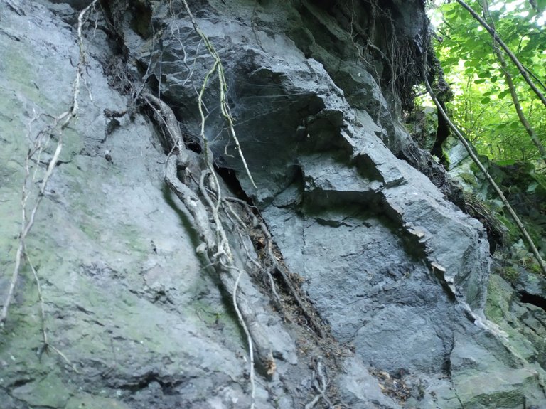
Cestou nahoru se zastavíme u bývalých štol na těžbu grafitu. Jsou zde tři štoly se zamřížovaným vstupem. Tady jsem litoval, že sebou nemám pořádné světlo. Tak jen jeden snímek s bleskem do jedné ze štol.
Cestou nahoru se zastavíme u bývalých štol na těžbu grafitu. Jsou zde tři štoly se zamřížovaným vstupem. Tady jsem litoval, že sebou nemám pořádné světlo. Tak jen jeden snímek s bleskem do jedné ze štol.
We turn right at the small bridge. A rather steep climb to the top of the Mountain awaits us.
On the way up, we stop at the former graphite mining galleries. There are three galleries with a barred entrance. Here I regretted not having a proper light with me. So just one photo with a flash in one of the galleries.
On the way up, we stop at the former graphite mining galleries. There are three galleries with a barred entrance. Here I regretted not having a proper light with me. So just one photo with a flash in one of the galleries.
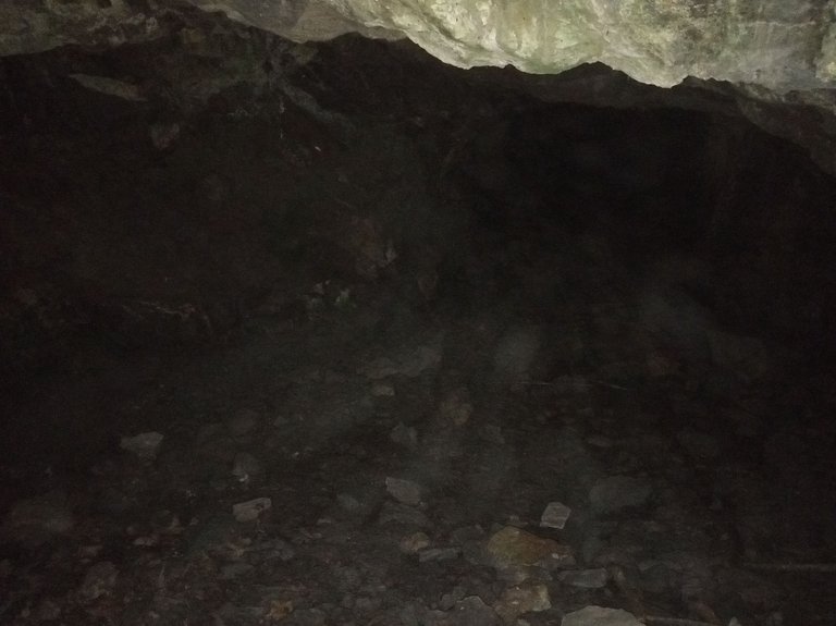
Drobné úlomky grafitu a grafitová žíla ve skále vám dají představu o tom, co se tady před sto lety těžilo.
Small fragments of graphite and a graphite vein in the rock will give you an idea of what was mined here a hundred years ago.
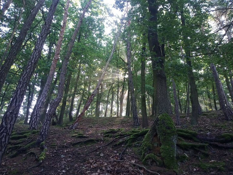
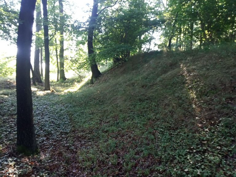
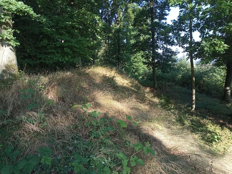
Po několika desítkách metrů prudkého stoupání se dostaneme na vrchol Hory. Co nás tu čeká? Dubový les, celkem dobře patrné pozůstatky obranných valů bývalého hradiště a samozřejmě je tu dost kamenů :-).
After a few dozen meters of steep climb, we reach the top of the Mountain. What awaits us here? An oak forest, quite clearly visible remains of the defensive ramparts of the former fort and of course there are plenty of stones :-).
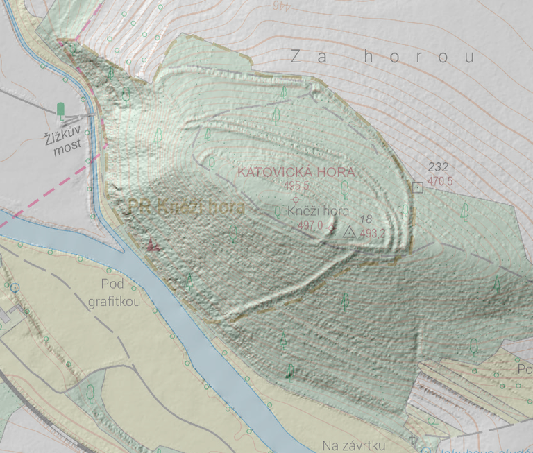
Aby jste si udělali představu o rozloze bývalého hradiště, udělal jsem screenshot z Lidaru(4), na kterém jsou dobře patrné obranné valy. Na fotografiích mi trochu „překážela vegetace“ :-).
To give you an idea of the size of the former fort, I took a screenshot from Lidar(4), on which the defensive ramparts are clearly visible. In the photos, I am a little "vegetation got in the way" :-).
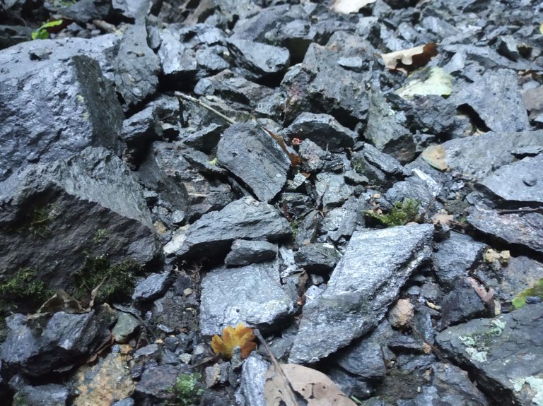
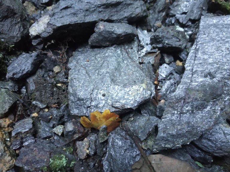
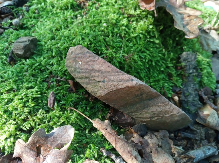
Samozřejmě jsem si vyfotil i nějaké kameny.
„Rezavě zbarvené“ kameny jsou (podle odborníků) vyžhavené velkým žárem, což znamená, že hradiště zaniklo v důsledku požáru.
„Rezavě zbarvené“ kameny jsou (podle odborníků) vyžhavené velkým žárem, což znamená, že hradiště zaniklo v důsledku požáru.
Of course I also took a picture of some stones.
"Rust-colored" stones are (according to experts) burned by great heat, which means that the fort disappeared as a result of a fire.
"Rust-colored" stones are (according to experts) burned by great heat, which means that the fort disappeared as a result of a fire.
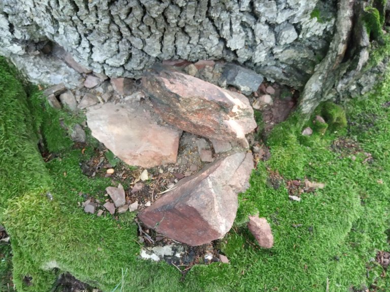
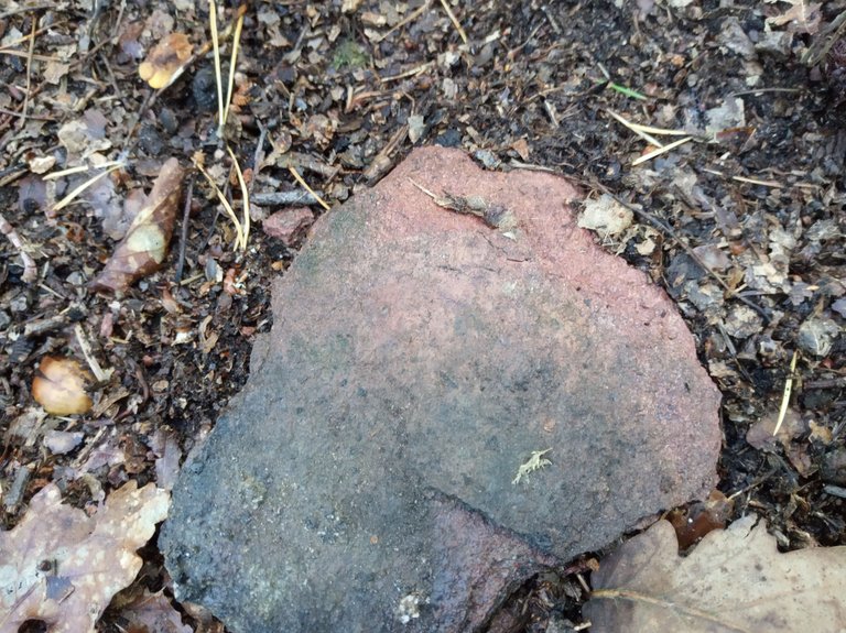
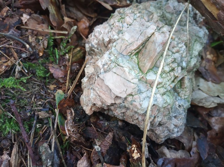
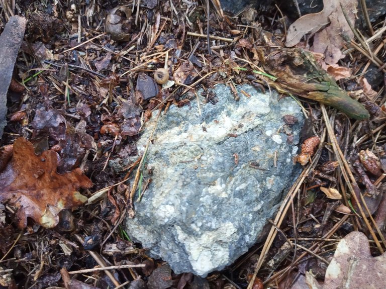
Přidám k tomu ještě několik dalších kamenů, které se mi líbily pro jejich strukturu.
I will add a few more stones that I liked for their structure.
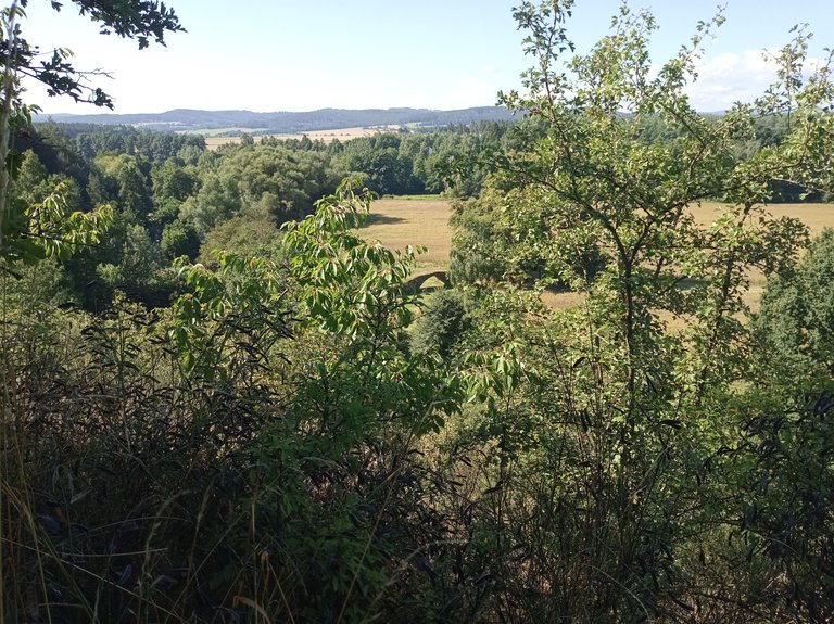
Pro sestup z Hory jsem si vybral jinou cestu. Bylo tu méně stromů a tak tu byl pěkný výhled k jihozápadu.
Vidíte ty duby uprostřed fotografie?
Vidíte ty duby uprostřed fotografie?
I chose a different route to descend from Hora. There were fewer trees here and so there was a nice view to the southwest.
Do you see the oak trees in the middle of the photo?
Do you see the oak trees in the middle of the photo?
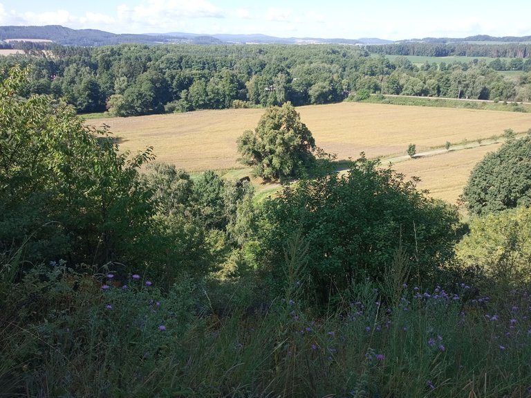
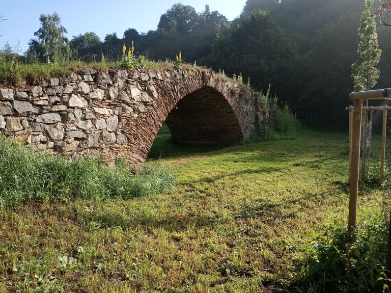
Hned vedle nich se skrývá starý most. To je ten „oblouk“ :-).
There is an old bridge hidden right next to them. That is the "arch" :-).
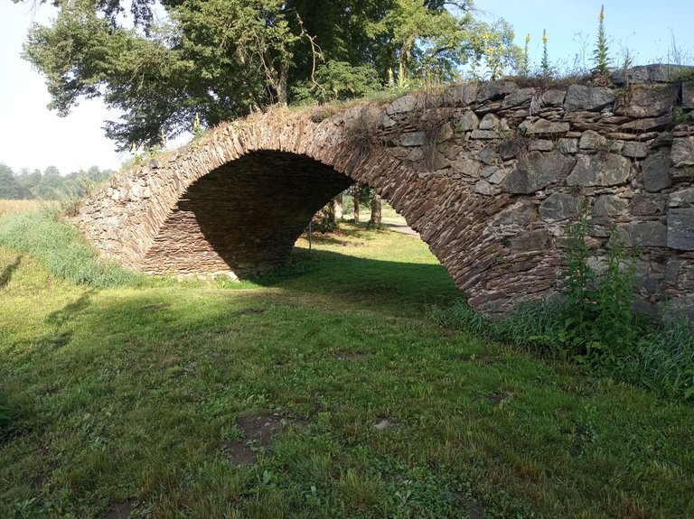
Půjdeme se tam podívat.
Jakmile je v Čechách něco hodně staré, můžou za to buď "Švédi" nebo vojevůdce Žižka :-). Proč to píšu? Protože se traduje, že most dal postavit právě husitský vojevůdce Jan Žižka. Podle některých odborníků je však most daleko mladší.
A ještě jedna zajímavost. Určitě jste si už při pohledu shora všimli, že pod mostem nic neteče. Vysvětlení je prosté. Potok, který most původně překlenoval byl „odstěhován“ k úpatí Katovické Hory :-).
We will go and take a look.
Whenever something is very old in Bohemia, either the "Swedes" or the military leader Žižka are responsible for it :-). Why am I writing this? Because it is said that the bridge was built by the Hussite military leader Jan Žižka. However, according to some experts, the bridge is much younger.
And one more interesting fact. You have certainly noticed when looking from above that nothing flows under the bridge. The explanation is simple. The stream that the bridge originally spanned was "moved" to the foot of Katovická Hora :-).
Doufám, že jsem vás moc nenudil a povedlo se mi ukázat vám pár zajímavostí jihočeského kraje.
I hope I didn't bore you too much and I managed to show you a few interesting things about the South Bohemian region.


Poznámka:
Zde jsou odkazy, kde si můžete přečíst nějaké informace o navštívených místech.
Zde jsou odkazy, kde si můžete přečíst nějaké informace o navštívených místech.
Here are links where you can read some information about the places visited.
Source:
(1) https://cs.wikipedia.org/wiki/Kn%C4%9B%C5%BE%C3%AD_hora_(hradi%C5%A1t%C4%9B)
(2) https://pamatkovykatalog.cz/zizkuv-most-18788974
(3) https://cs.wikipedia.org/wiki/Grafit
0
0
0.000
You can check out this post and your own profile on the map. Be part of the Worldmappin Community and join our Discord Channel to get in touch with other travelers, ask questions or just be updated on our latest features.
Congratulations, your post has been added to the TravelFeed Map! 🎉🥳🌴
Did you know you have your own profile map?
And every post has their own map too!
Want to have your post on the map too?
- Go to TravelFeed Map
- Click the create pin button
- Drag the marker to where your post should be. Zoom in if needed or use the search bar (top right).
- Copy and paste the generated code in your post (any Hive frontend)
- Or login with Hive Keychain or Hivesigner and click "create post" to post to Hive directly from TravelFeed
- Congrats, your post is now on the map!
PS: You can import your previous Pinmapple posts to the TravelFeed map.Opt Out
What a beautiful place and journey you visited.
Show us what beauties and attractions you have
Congratulations @bucipuci! You received the biggest smile and some love from TravelFeed! Keep up the amazing blog. 😍 Your post was also chosen as top pick of the day and is now featured on the TravelFeed front page.
Thanks for using TravelFeed!
@for91days (TravelFeed team)
PS: Did you know that we have our own Hive frontend at TravelFeed.com? For your next travel post, log in to TravelFeed with Hive Keychain or Hivesigner and take advantage of our exclusive features for travel bloggers.
Thank you for your support @travelfeed and @for91days. It's an honor.
Zajímavé místo. Ten most by se hodil filmařům do nějaké pohádky :-)
Na lidaru je terén pěkně vidět.
Jako filmovou kulisu bych si ho dovedl představit :-). Je zajímavé, že ho, při regulaci potoka, nezbourali. Ale asi by to byla "svatokrádež".
Lidar používám dost často. Dobře se na něm hledají různé propadliny, lomy a tak podobně :-)
;-)
Katovicka Hora? I live very near Katowice! ;-)
"Only" 500 km away :-)
Hello bucipuci!
It's nice to let you know that your article will take 14th place.
Your post is among 15 Best articles voted 7 days ago by the @hive-lu | King Lucoin Curator by polish.hive
You receive 🎖 0.2 unique LUBEST tokens as a reward. You can support Lu world and your curator, then he and you will receive 10x more of the winning token. There is a buyout offer waiting for him on the stock exchange. All you need to do is reblog Daily Report 735 with your winnings.
Buy Lu on the Hive-Engine exchange | World of Lu created by szejq
STOPor to resume write a wordSTART